Red Flat
The Red Flat Nickel Property is located in southwest Oregon (Figure 1) approximately 15 km east of Gold Beach (2020: pop. 2,241) and 480 km south of the City of Portland, Oregon’s largest city by population (2021: 641,162). The property is in a mountainous forested area that can be accessed using a four-wheel drive truck from highway 101 via the Hunter Creek Road (Figure 2).
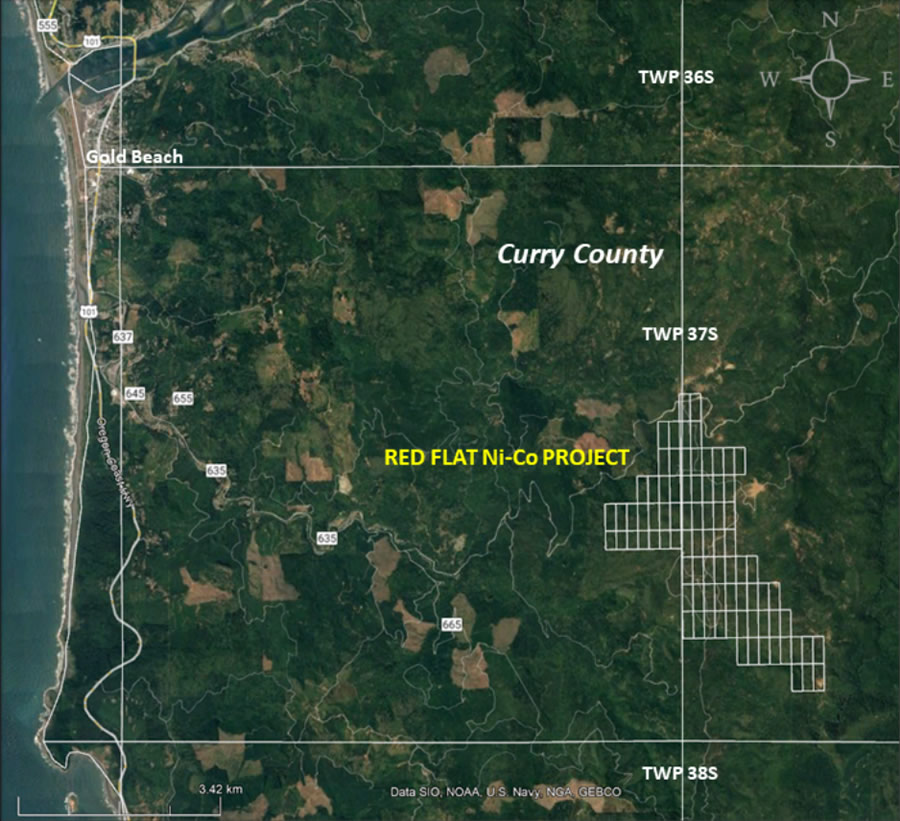
Figure 1 - Location of Red Flat project area.
Red Flat contains a historic resource of nickel laterite totaling 18.8 Mt grading 0.84% Ni (nickel) using a 0.7% Ni cut-off. This resource represents 317 million pounds (144 thousand tonnes) of contained nickel (Table 1). The resource is divided into soil and rock and contains measured, indicated, and inferred categories. The resource is considered historic as it was calculated in 2009 to National Instrument 43-101 standards based on combined exploration programs from 2007-2009 but never published.
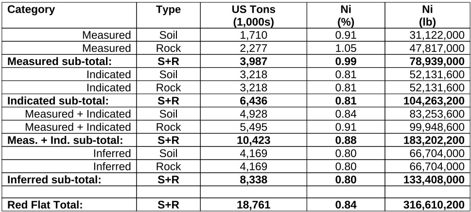
Table 1-3. Summary of the 2009 historical mineral resource estimation, Red Flat Ni Deposit (0.7% Ni cut-off).
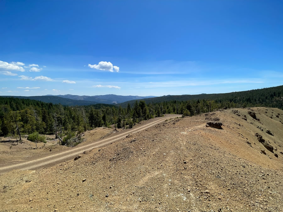
Figure 2 - Red Flat can be accessed directly via gravel road.
The Property consists of 84 Lode mining claims (Figure 3) covering an area of 815 ha (2,015 ac). The claims are in Curry County on Federal land administered by the Bureau of Land Management (BLM) but also subject to rights and regulations implemented by Oregon’s Mineral Land Regulation and Reclamation Board with exploration permits granted by the Department of Geology and Mineral Industries (DOGAMI).
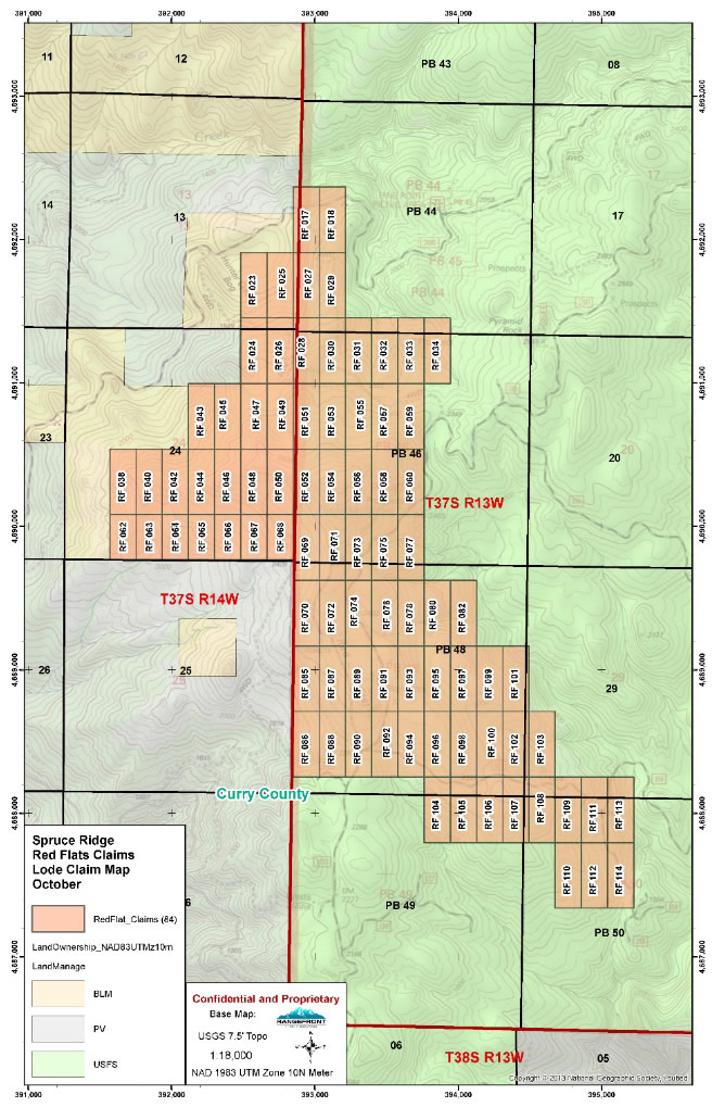
Figure 3 - Location of individual mining claims at Red Flat.
The Property is covered by ultramafic rocks and schist formations. The ultramafic rocks are mainly peridotite, harzburgite, and dunite, variably serpentinized and later altered into a lateritic weathering profile consisting of nickel-upgraded soil and rock. The laterite zones are located within this large altered ultramafic unit that extends across the entire property (Figure 4) and that was mapped during previous exploration programs.
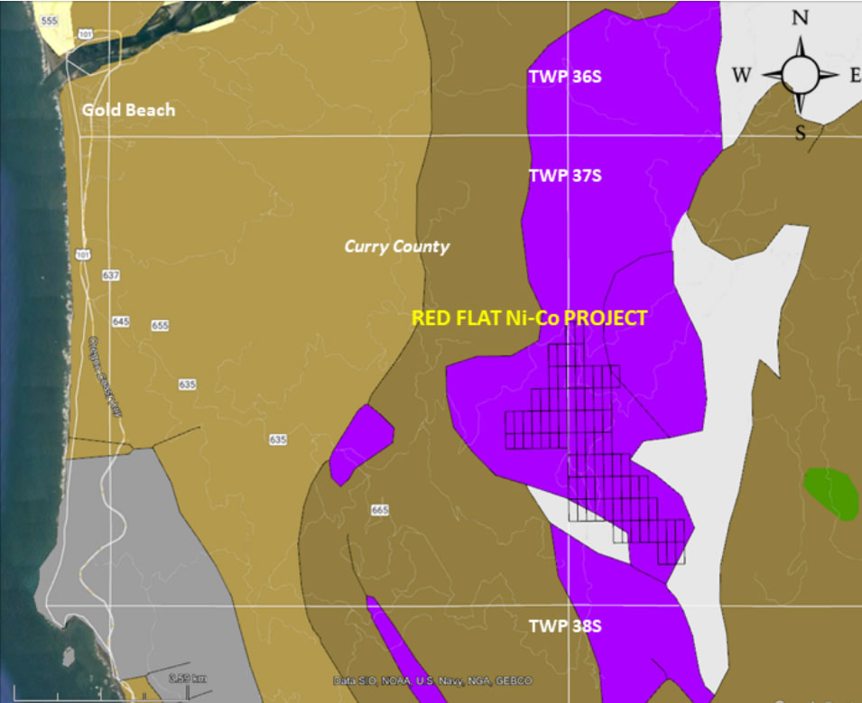
Figure 4 - Nickel is contained within a large ultramafic unit (mapped in purple).
Mineralization is contained within both soil and rock with nickel grades slightly higher in the rock. In areas with laterite at surface, the ground takes on a slight red appearance due to the presence of iron. Nickel laterite typical of Red Flat is shown in Figure 5 with both soil and rock visible.
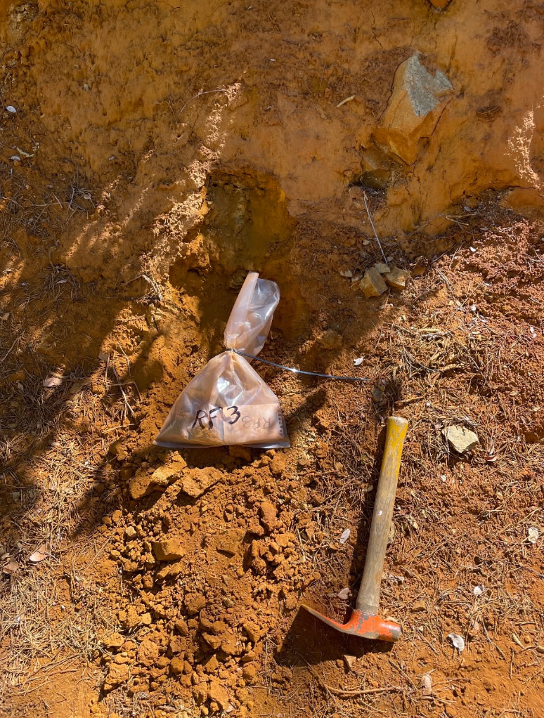
Figure 5 - Nickel laterite sampled at red Flat returned greater than 1% Ni in sample RF-3.
The exploration depth has been relatively shallow with the deepest augured hole reaching 18.3 m (60 ft) and having an average grade of 0.7% Ni. But the average exploration depth is only (8.6 m) 28.3 ft. Nickel grade has been reported to increase with depth and the basement rocks have never been reached.
The possibility exists to significantly increase the resource at Red Flat by extending the average exploration depth to 15 m (50 ft), an almost 50% increase. Homeland Nickel is proposing an exploration program of up to 50 vertical drillholes (using a sonic drill) to a maximum depth of 50 feet based on a uniform grid of 600 feet by 1,200 feet to expand the resource and with a sampling program to acquire enough material for future mineralogical and metallurgical work. Assays are expected to be sampled at 1 m (3 ft) intervals.