Cleopatra
The Cleopatra Property is located in southwest Oregon (Figure 1) adjacent to the California-Oregon border and within Curry County. The closest major center is the City of Grants Pass (pop 2021: 39,364) located 100 km to the northeast. The City of Portland (pop 2021: 641,162), Oregon’s largest city, is located 539 km to the north. Cleopatra is in a mountainous forested area that can be accessed from US Highway 101 (from the north) or from Highway 199 (from the south).
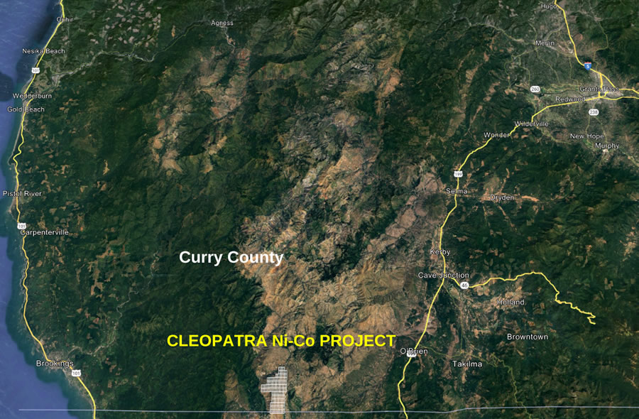
Figure 1 - Location map of the Cleopatra Nickel Property.
The Property consists of 139 Lode mining claims (Figure 2) covering a total area of 1,162 ha (2,872 ac). The claims are located on Federal land under control of the Bureau of Land Management but are also subject to rights and regulations implemented by Oregon’s Mineral Land Regulation and Reclamation Board with exploration permits granted by the Oregon Department of Geology and Mineral Industries (“DOGAMI”).
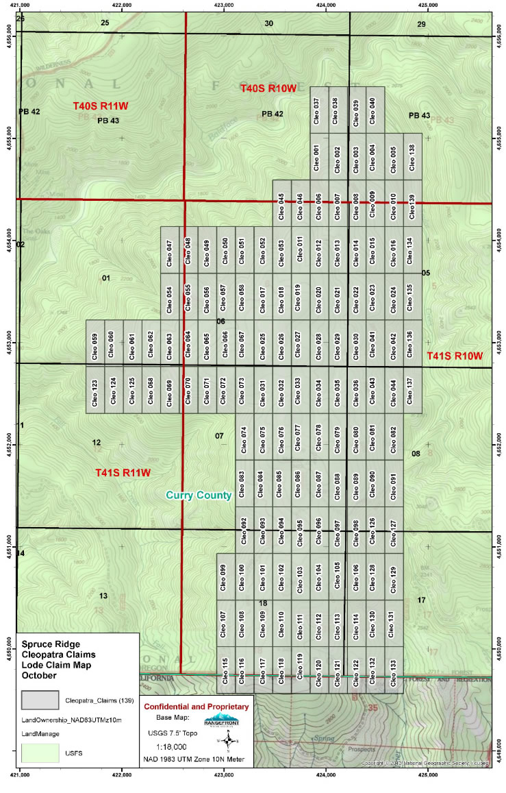
Figure 2 - Cleopatra claim map as at October, 2023.
Nickel was discovered in the region as far back as 1881. Nickel laterite was mined at the nearby Riddle Mine during the period 1954 to 1976 and provided 39 Mt of ore grading 1.0-1.5% Ni. In 1978 DOGAMI conducted preliminary exploration at Cleopatra (Ramp, 1978). Access to the property is by four-wheel drive truck along a gravel road (see Figure 3).
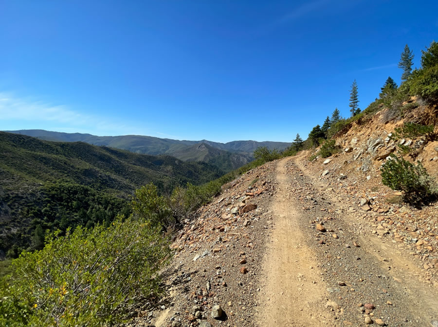
Figure 3 - Access to Cleopatra is via gravel road that runs through the property.
Exploration continued from 2007-2009 by the Red Flat Nickel Corporation (now “Homeland Nickel”) with an extensive program of augered holes. This program defined a resource of measured, indicated, and inferred nickel (see Table 1). A subsequent report (Rancourt, 2009) was never published so the resource is classified as historical.
Based on the 2007-2009 exploration program a total historical resource of 39.5 Mt grading 0.93% Ni was delineated. This resource represents 743 million pounds (337 thousand tonnes) of contained Ni.
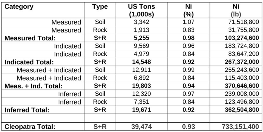
Table 1. Summary of the 2009 historical resource, Cleopatra Ni Deposit (0.7% Ni cut-off).
The resource at Cleopatra was derived from hand-augering on a uniform 90 m by 90 m (300 ft by 300 ft) grid. The deepest auger hole was 7 m (23 ft) with only 3 auger holes deeper than 6.2 m (20 ft). The average exploration depth was 2.5- 3.7 m (8-12 ft). Cobalt (Co) and Chromium (Cr) are also present. A typical surface exposure of the laterite is shown in Figure 4. The material at surface is predominantly soil but some mineralized rock is also present.
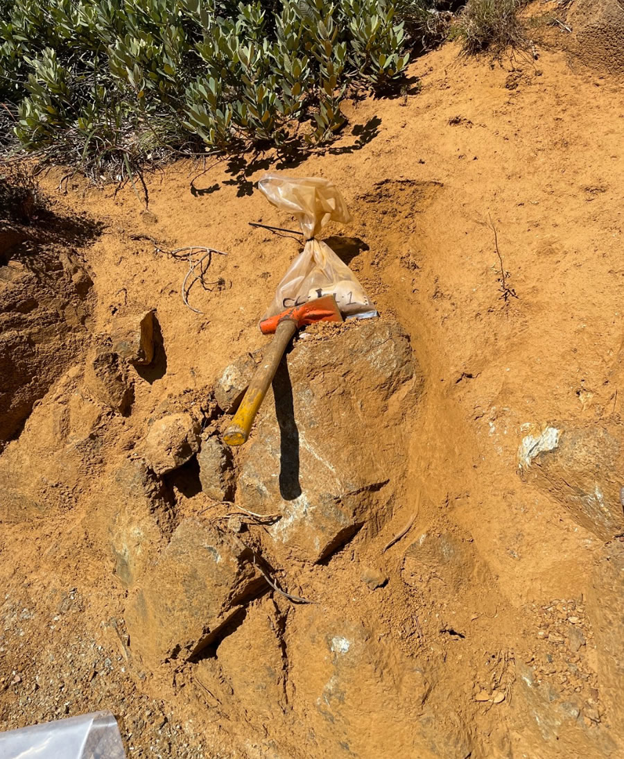
Figure 4 - Nickel laterite at Cleopatra showing soil and rock (both mineralized).
Cleopatra contains a higher-grade zone that covers roughly 30% of the mining claims (384 ha or 949 ac) where nickel grades average 1.12% Ni (Figure 5). This area will be the focus of the 2024 exploration program (subject to permitting) whereby Homeland Nickel will extend the exploration depth to 15 m (50 ft) by drilling up to 70 holes using a sonic drill and acquiring a bulk sample of laterite for metallurgical work.
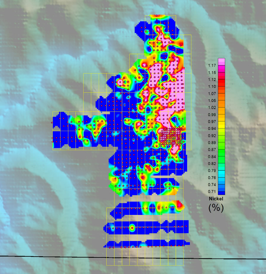
Figure 5 - The northeast section of Cleopatra averages 1.12% Ni over 949 ac.
The higher-grade area at Cleopatra represents an approximate tonnage of 8-10 Mt per vertical metre. This suggests that the higher-grade portion of the resource could more than double the total resource if the laterite extends to a depth of 15 m (50 ft) or more. The higher-grade area represents only 30% of the property and historic work has confirmed the presence of nickel mineralization with grades of 0.7% Ni and higher across almost all the remaining claims.
Based on the above analysis we believe Cleopatra to be one of the largest undeveloped nickel resources in the continental United States. The resource sits at surface and is easily mined.